How Does Sunset Beach Work? - Page 2
Very well, now that we know where we are, let's move on to some of the environmental factors that come into play at our chosen location, and we'll start off with the bottom profile out beyond the takeoff zone, and what that might mean for the waves which we are interested in riding.
As waves begin their final approach to the shoreline at Sunset Beach, they move away from the abyssal depths of the open Pacific Ocean where the water runs two or three miles deep, start feeling the bottom over the submerged flank of the Ko'olau shield volcano, and begin slowing down, more here, less there, but not too much anywhere, and begin to assume their final form. The illustration below, showing SWAN modeling of wave heights as opposed to the bottom profile that it strongly resembles, taken from "Empirical Surf Height Estimates, by Caldwell and Aucan, 2007" is revealing. Please note the wave sizes are given in meters, and that the solid line running more or less parallel to the shore, is the 20 meter (65 foot) depth contour.
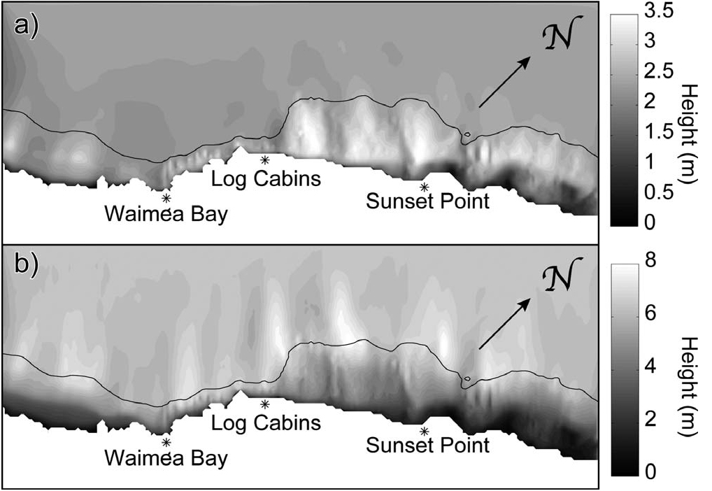
Figure 2. (a) SWAN model significant wave height estimates (m) for a
typical winter deepwater swell of 2.5 m at 14 s from 315°
(b) Similar
output under extreme offshore swell of 6.5 m at 18.6 s from 317° The
solid line denotes the 20-m depth contour.
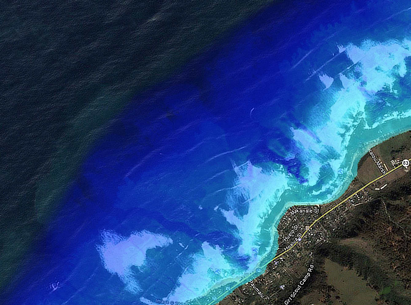
Compare the above with the actual bottom profile, as revealed by LIDAR, below, keeping in mind that the scales are different, and of course the general alignment of the images isn't the same either. The bottom profile that exists seaward of Sunset Beach is a very busy place, loaded with numerous features. There exists much that will have an effect on any long-period waves traveling across it from any given direction. The image below is quite instructive, but just from a very cursory examination of things, I find myself believing that someone, for whatever reason, during the data-reduction and image-generation phase of things, decided to place a pretty strong brightness gradient upon things, more or less right at the very same 20 meter depth contour that is shown in the above image depicting modeled wave heights. For the purposes which I intend to pursue, this pronounced brightness gradient tends to mask information that I believe to be worthy of a closer look.
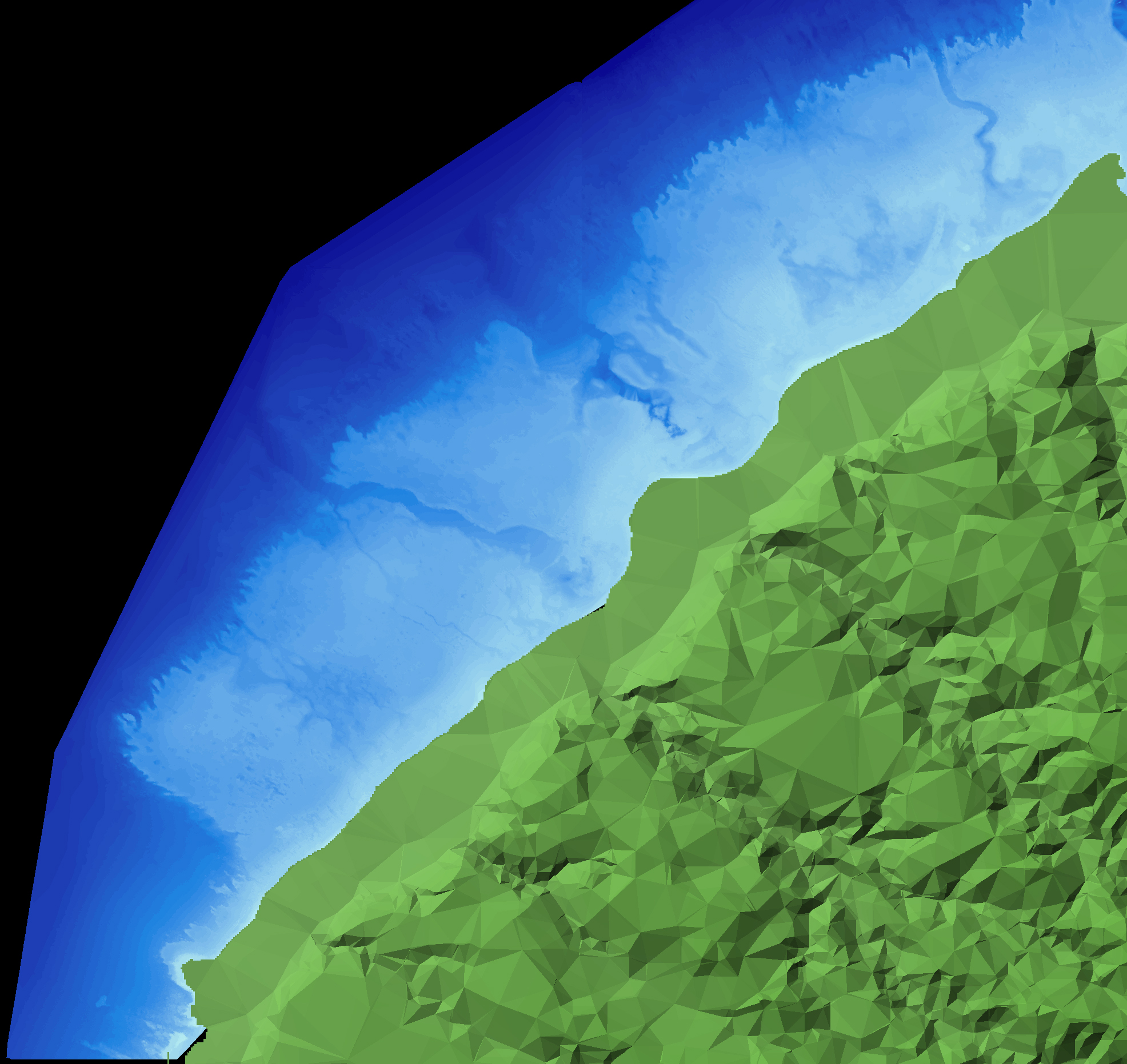
SHOALS LIDAR Bathymetry for Oahu,
University of Hawaii, Manoa - Coastal Geology Group
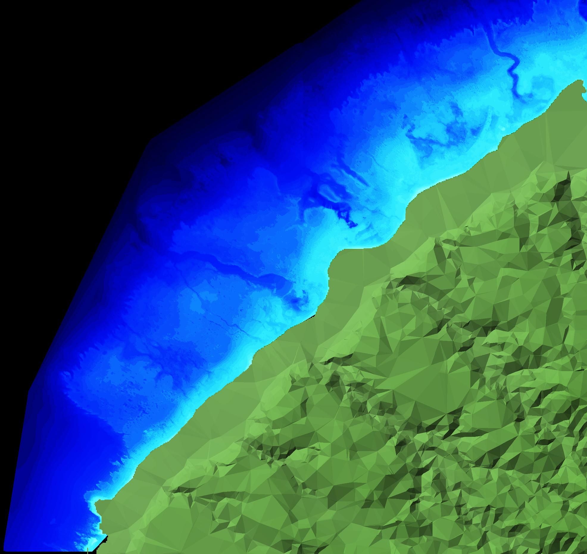
Click the image to bring it up full-size, and if you need to click it again, to force your browser to render it at actual size, then by all means do so. Then, using the full-size rendering, take your time examining the area between and around the two drowned stream valleys that flank Sunset Point, from the shoreline, all the way out. There is much here to see and consider, and first impressions may or may not be as accurate as you might imagine.
Next, we will overlay some waves on top of our bathymetry, and examine the look of things in combination.
The above caveats notwithstanding, the sense of things seems clear enough.
One of the things you learn pretty quick when you arrive on the North Shore is that Sunset Beach is always bigger than everywhere else.
Always.
Without fail, no matter what the swell direction, be it west, northwest, or north, so long as it's not rolling through with solid whitewater from a mile out there, so long as the takeoff zone has moved out and away from the point and it's coming over in some kind of an organized peak, wave size is always larger at Sunset Beach than it is everywhere else along the entire expanse of the North Shore.
How might a thing like that actually work?
What exactly is going on at Sunset Beach to cause that to happen?
In particular, the part about all swell directions.
That part of things, when you give it some consideration, stands out as very unusual and is not a phenomenon that can be found commonly, or at all, anywhere else in the world.
Pipeline, which is just down the coast, is instructive in this regards. Sunset and Pipeline both break on west swells. But if you send some strongly-angled north swell into the beach at Pipeline, Pipeline disappears.
Send some strongly-angled north to the beach at Sunset, and Sunset just gets better.
And I can't think of anywhere else that I've ever heard of that does it under as wide a sweep of swell directions, either.
So again, what's actually occurring at Sunset Beach?
Let us return to the picture above, on the next page, and take a closer look at things.
Return to 16streets.comMaybe try to email me? |